This is the most comprehensive List of the top 15 largest Nigerian states by land area:
Rank | State | Land Area (sq km) | Capital City |
|---|---|---|---|
1 | Niger | 74,363 | Minna |
2 | Borno | 70,898 | Maiduguri |
3 | Taraba | 54,473 | Jalingo |
4 | Kaduna | 46,053 | Kaduna |
5 | Bauchi | 45,893 | Bauchi |
6 | Yobe | 45,502 | Damaturu |
7 | Zamfara | 39,762 | Gusau |
8 | Adamawa | 36,917 | Yola |
9 | Kwara | 36,825 | Ilorin |
10 | Kebbi | 36,800 | Birnin Kebbi |
11 | Benue | 34,059 | Makurdi |
12 | Plateau | 30,913 | Jos |
13 | Kogi | 29,833 | Lokoja |
14 | Oyo | 28,454 | Ibadan |
15 | Nasarawa | 27,117 | Lafia |
READ ALSO: Freedom Fighters In Nigeria
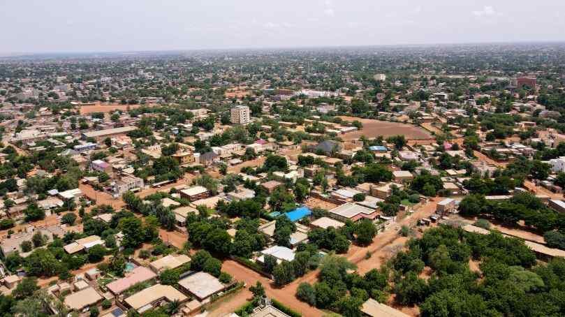
Niger State – 76,363 km²
Niger State is the largest state in Nigeria by land area, covering about 76,363 square kilometers. It is located in the North Central part of Nigeria and is bordered by several other states.
To the west, it shares a border with Kebbi, while to the north, it is adjacent to Zamfara. Kaduna lies to the northeast, Kogi to the southeast, Kwara to the south, and the Federal Capital Territory (FCT) to the east.
Niger State also has an international boundary with the Republic of Benin to the northwest. The state capital is Minna, which is an important center for administration and business.
Other major towns include Bida, Kontagora, and Suleja. As of 2022, Niger State had a population of over 5.8 million people, with a density of around 51 people per square kilometer.
The main ethnic groups in the state are the Nupe, Gbagyi (Gwari), and Hausa, among others. And the people of Niger State speak a variety of languages and have a rich cultural heritage.
Agriculture is very important in Niger State, with more than 80% of the people working in farming. Key crops grown in the state are millet, maize, rice, yams, and cowpeas.
Niger State is also rich in minerals such as gold, talc, limestone, and marble. It is home to three major hydroelectric power stations: Kainji Dam, Jebba Dam, and Shiroro Dam, which are a big part of Nigeria’s electricity supply.
Tourism in Niger State is supported by attractions like Kainji Lake National Park and Gurara Falls. The state has a tropical climate with both wet and dry seasons, which helps with farming.
Borno State – 70,898 km²
Borno State is a large area in northeastern Nigeria, covering 70,898 square kilometers. It is the second-largest state in Nigeria. Borno was created on February 3, 1976, from the old North-Eastern State, and its capital city is Maiduguri.
Borno is bordered by three countries: Niger to the north, Chad to the northeast, and Cameroon to the east. It also shares borders with other Nigerian states: Yobe to the west, Gombe to the southwest, and Adamawa to the south.
This location makes Borno an important area in the region. As of 2022, Borno had a population of over 5.90 million people. The state is mainly home to the Kanuri ethnic group, along with smaller groups like the Lamang, Babur, and Marghi.
The primary religions in Borno are Islam and Christianity. However, the economy of Borno is based mostly on agriculture. People grow crops such as sorghum, millet, corn (maize), rice, cotton, and indigo.
The state is also known for raising livestock, especially cattle. Fishing is important too, due to Lake Chad, which is nearby. Geographically, Borno has a mix of semi-desert savanna in the north and West Sudanian savanna in the south.
Notable natural features include parts of Lake Chad and the Chad Basin National Park, which is home to animals like elephants and many bird species.
READ ALSO: Who Built ASO Rock (History Of ASO Rock)
Taraba State – 54,473 km²
Taraba State is one of the largest states In Nigeria with an area of 54,473 square kilometers. It was created on August 27, 1991, from the old Gongola State.
With around 4.1 million people living there, Taraba is known for its natural beauty and cultural richness, earning the nickname “Nature’s Gift to the Nation.”
The state is bordered by Nasarawa and Benue States to the west, Bauchi and Gombe States to the north, Adamawa State to the northeast, and Cameroon to the south.
The geography is varied, with wooded savanna in the north and mountainous areas in the south. Also, the Mambilla Plateau, which is about 1,800 meters (6,000 feet) above sea level, has a cooler climate compared to the rest of the state, which experiences a tropical wet and dry climate.
Taraba is home to over 80 different ethnic groups, including the Jukun, Mambilla, Fulani, and Mumuye. This diversity is seen in the many languages, traditions, and festivals throughout the state.
The economy of Taraba is largely based on agriculture. People grow crops like cassava, maize, rice, and yams, and also cultivate cash crops such as tea and coffee, especially on the Mambilla Plateau.
Livestock farming, including cattle, sheep, and goats, is also important. The state has 16 Local Government Areas (LGAs), including Ardo Kola, Bali, Donga, Gashaka, Gassol, Ibi, Jalingo (the capital), Karim Lamido, Kurmi, Lau, Sardauna, Takum, Ussa, Wukari, Yorro, and Zing.
Tourism is a key part of Taraba’s economy. Visitors come to see attractions like the Gashaka-Gumti National Park, Nigeria’s largest national park with a rich variety of wildlife, and the beautiful Mambilla Plateau. Cultural festivals such as the Asamu Festival in Jalingo also draw tourists.
Kaduna State – 46,053 km²
Kaduna State, located in the northwestern part of Nigeria is the fourth largest state in the country, with an area of 46,053 square kilometers.
Established in 1967, the state’s capital, also called Kaduna, was chosen in 1913 by Sir Frederick Lugard as a new town along the Lagos-Kano Railway.
Since then, Kaduna has become a major center for industry, commerce, and finance in northern Nigeria. Today, Kaduna is popular for its textile industry, with many mills producing fabrics from cotton.
The city also has a strong food industry, producing beer, soft drinks, baked goods, and processed meat. Kaduna State has a varied population.
In the north, the Hausa and Fulani ethnic groups are prominent, while the south is home to around 30 other ethnic groups, including the Gbari (Gwari). Most people in the state practice Islam, but there are also Christians and practitioners of traditional beliefs.
Agriculture is a key part of the economy. The state grows crops like cotton, peanuts, shea nuts, ginger, peppers, and vegetables. Tobacco is a major crop around Zaria, where cigarettes are made, and sorghum is used in a brewery in Kaduna.
Livestock farming is also important, with cattle, chickens, guinea fowl, and sheep raised throughout the state. Kaduna is known for its educational institutions, including Ahmadu Bello University in Zaria, one of the leading universities in Nigeria.
There are also several other colleges and institutes, like the Nigerian Defense Academy, Kaduna Polytechnic, and Kaduna State University. However, the state is divided into 23 local government areas.
Birnin Gwari is known for its rocky terrain and beautiful landscapes, while Zaria is famous for its historic city and university. Despite challenges like the recent bandit attacks, Kaduna State remains an important part of Nigeria.
READ ALSO: List Of CBN Governors Of Nigeria (1958-Present)
Bauchi State – 45,837 km²
Bauchi State, created on February 3, 1976, is the fifth largest state in Nigeria, covering 45,837 square kilometers. The state is surrounded by seven other states: Kano and Jigawa to the north, Taraba and Plateau to the south, Gombe and Yobe to the east, and Kaduna to the west.
Bauchi State is divided into 20 local government areas. These areas are Bauchi, Tafawa Balewa, Dass, Toro, Bogoro, Ningi, Warji, Ganjuwa, Kirfi, Alkaleri, Darazo, Misau, Giade, Shira, Jama’are, Katagum, Itas/Gadau, Zaki, Gamawa, and Damban.
According to the 2022 census, the state’s population is 8,653,066, making it the ninth most populous state in Nigeria. Agriculture is the main part of Bauchi State’s economy.
Major crops include cotton, groundnuts, millet, tomatoes, and yams. The state has a rich history, with its emirate founded in the early 1800s by Yakubu, a leader of the Fulani jihad.
There are over 55 ethnic groups in the state, such as the Hausa, Fulani, Jarawa, Tangale, Waja, Balewa, Sayawa, and Tarewa.
Bauchi State features the Yankari National Park, known for its hot spring at Wikki, and has valuable mineral resources like tin, columbite, coal, limestone, iron ore, antimony, and marble.
thanks