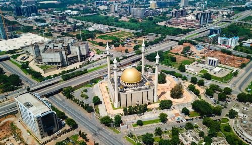
Abuja, Nigeria’s Federal Capital Territory (FCT), is a rapidly growing metropolis with an annual urban expansion rate of 13%, making it one of Africa’s fastest-developing cities.
The FCT is organized into major districts, such as Asokoro, Garki, Maitama, Wuse, and Lugbe, each serving distinct roles in administration, commerce, and residential life.
These districts host key government institutions, embassies, and commercial centers, and are managed by the Abuja Municipal Area Council (AMAC) and the Federal Capital Development Authority (FCDA).
READ ALSO: Top 10 Richest Local Government In Enugu state, Nigeria
What Are The Major Districts In Abuja?
Here are 10 major cities or urban districts in Abuja’s Federal Capital Territory (FCT):
- Asokoro
- Garki
- Maitama
- Wuse
- Kado
- Durumi
- Jabi
- Mabushi
- Gudu
- Katampe
1. Asokoro
Asokoro is a major district in Nigeria’s Federal Capital Territory (FCT), located in Abuja. Located to the east of Garki and just south of the Central Area, Asokoro is known for its high-profile status and political value.
Asokoro falls under the Abuja Municipal Area Council (AMAC), part of the FCT, established in 1976. It is regarded as one of the most prestigious and secure neighborhoods in the city.
This district is home to top government officials, including nearly all federal cabinet ministers. Most notably, it houses the Presidential Palace, commonly known as Aso Rock, which is the seat of the Nigerian presidency.
Asokoro is tightly guarded and heavily protected, making it one of the safest places in Nigeria. Many key institutions are located there, including the ECOWAS Secretariat. The district also enjoys excellent road access to Nnamdi Azikiwe International Airport.
2. Garki
Garki is a key district in the southwestern part of Abuja, bordered by the Central District to the north and Asokoro to the east.
It is one of the oldest and most prominent areas in Nigeria’s Federal Capital Territory (FCT), and is divided into numbered areas, from Area 1 to Area 11.
Garki II is separately identified from Area 2. It serves as Abuja’s main business district. Notable landmarks include the Abuja International Conference Centre, Nicon Luxury Hotel, Agura Hotel, and the General Post Office.
The Old Federal Secretariat is located in Area 1. Area 2 is mostly residential, while Area 7 is known for banks and offices along Moshood Abiola Way.
Garki is also the seat of major government and military institutions. These include the Army, Navy, and Air Force Headquarters.
The tallest building there, Radio House, hosts the Ministry of Information and the Federal Radio Corporation of Nigeria.
Also, the Nigerian Television Authority (NTA) and the Central Bank of Nigeria have offices there. The Federal Capital Development Authority (FCDA) and the Office of the FCT Minister are based in Area 10.
3. Maitama
Maitama is one of the most elite and expensive districts in Abuja, Nigeria’s Federal Capital Territory (FCT).
Located in Phase 1 of Abuja’s master plan, Maitama is in the north of the city center, sharing borders with Mpape, Wuse, Katampe, and the Central Area.
The district sits at coordinates 9.0845°N and 7.4917°E. Planned and developed in the 1970s, Maitama officially became part of the FCT on October 1, 1984.
It was designed to be a high-class residential and diplomatic zone. And looking at it now, it houses many embassies, top government buildings, and luxury homes.
Streets like Shehu Shagari Way, Aguiyi Ironsi Street, and Nnamdi Azikiwe Expressway run through the area.
The Koro people, who migrated from Zaria around 1715, were the earliest settlers. The name “Maitama” is linked to iron smelting, which once took place there.
Maitama is home to landmarks like Millennium Park, the IBB Golf Club, Unity Fountain, and the Transcorp Hilton Hotel. Notable institutions in the city include the NCC, INEC, NYSC, and NUC.
The area falls under the Abuja Municipal Area Council (AMAC) and is managed by the Federal Capital Development Authority (FCDA). A newer extension, Maitama II, is now being developed near Mpape Hills to meet rising demand.
4. Wuse
Wuse is one of the major urban districts in Abuja, Nigeria’s Federal Capital Territory. It borders Maitama to the northeast, the Central Business District to the southeast, Utako to the northwest, and Wuye to the southwest.
Divided into eight zones: Wuse Zones 1 through 8, the area combines residential comfort with commercial activity.
Each zone has a network of interconnected roads. Wuse is one of Abuja’s busiest and most upscale districts. It hosts numerous federal offices, banks, hotels, and private businesses.
Wuse Zone 2 is home to the famous Wuse Market, the largest open market in Abuja, open daily from 8:00 a.m. to 6:00 p.m. Bannex Plaza, located nearby, is a hotspot for electronics and mobile gadgets.
Zone 4 features Nigeria’s largest bureau de change hub, while Zone 3 hosts Wuse General Hospital and the ICT-focused Zone 3 shopping complex. The district also has over 50 hotels, ranging from 3-star to luxury 7-star, and several parks and gardens.
5. Kado
Kado is one of the major districts located in the Federal Capital Territory (FCT) of Nigeria. It falls under the Abuja Municipal Area Council (AMAC), one of six area councils that make up the FCT.
Kado is part of Phase 2 in Abuja’s city development plan, alongside other districts like Jabi, Utako, Durumi, and Gudu.
This district is well-planned and benefits from Abuja’s modern infrastructure. It features wide roads, clean streets, and easy access to key amenities.
The FCT’s rapid urban growth, estimated at around 13% per year, has boosted Kado’s development, particularly in real estate, construction, tourism, and services.
Kado is also a melting pot of cultures. The larger FCT is home to several ethnic groups, including the Gwari (Gbagi), Gade, Koro, and Egbura, with Hausa and Fulani communities also present.
Economically, Kado thrives, offering opportunities for investment in infrastructure, agriculture, real estate, power, and hospitality.
6. Durumi
Durumi is a prominent suburb located within the Abuja Municipal Area Council (AMAC), one of the six area councils of the Federal Capital Territory (FCT), Nigeria.
Geographically, Durumi sits at approximately 9.01946° N latitude and 7.46433° E longitude. The land is stable, resting on crystalline rocks like granite and gneiss. It also falls within the tropical savannah vegetation zone.
Administratively, Durumi is under the governance of AMAC, with oversight from the Federal Capital Territory Administration (FCTA).
The area is supported by agencies such as the Abuja Metropolitan Management Council (AMMC) and the Federal Capital Development Authority (FCDA).
These bodies handle infrastructure, land use, and city planning. Durumi is home to several key institutions, including the National Hospital Abuja, one of the FCT’s top healthcare centers. It’s also just 3.5 km away from the World Trade Centre Abuja, a symbol of rising commercial development.
READ ALSO: Top 10 Agriculture-Producing States In Nigeria (2025)
7. Jabi
Jabi is one of the major urban districts in Abuja, located within the Abuja Municipal Area Council (AMAC). It is well-known for its modern infrastructure, vibrant lifestyle, and growing economic influence.
Jabi is near other key districts like Wuse and Garki, benefiting from Abuja’s well-planned road network and organized city layout. Among the key landmarks in Jabi is the Jabi Lake Mall.
It is one of the largest shopping malls in Abuja and has a list of retail stores, restaurants, and entertainment spots.
The mall attracts thousands of visitors weekly, and it’s a huge part of the district’s commercial success. Also, the area sees strong growth in real estate, hospitality, and service industries.
Jabi is also home to the famous Jabi Lake, a man-made lake surrounded by green spaces and recreational parks.
This area is popular for outdoor events, fitness activities, and leisure. Supported by the Federal Capital Development Authority (FCDA), Jabi continues to benefit from modern roads, reliable power, and planned growth. It is a big part of Abuja’s urban expansion, which grows at a rate of about 13% annually.
8. Gudu
Gudu is a prominent district within Abuja’s Federal Capital Territory (FCT), located in the Abuja Municipal Area Council (AMAC).
It is strategically positioned in the central part of Abuja, contributing to the city’s organized urban layout and serving as both a residential and commercial zone.
Geographically, Abuja spans around 8,000 square kilometers and is bordered by Kaduna, Niger, Nasarawa, and Kogi states.
Gudu’s climate is tropical savannah, with a rainy season from March to October and a dry season from October to March.
While the Gwari (Gbagyi) people are the original settlers of the FCT, Gudu has grown into a cosmopolitan area, home to people from all parts of Nigeria.
The district benefits from Abuja’s master plan. It has good roads, electricity, water, and public transport.
READ ALSO: Top Oil Fields In Nigeria And Their Location
9. Katampe
Katampe is one of the major districts in the Federal Capital Territory, located within the Abuja Municipal Area Council (AMAC).
It sits on the eastern edge of AMAC, bordered by Katampe Hills to the north and the Abuja-Kubwa Expressway to the south.
Originally planned as a low-density diplomatic zone, Katampe has grown into a mixed-use area with increasing residential and commercial development.
Infrastructure development in Katampe began nearly 40 years ago with a major engineering project valued at about ₦61 billion. However, by 2017, less than 30% of the work had been completed.
The delays were blamed on weak procurement practices and poor supervision. To revive the project, FCT authorities proposed public-private partnerships aimed at aligning Katampe’s growth with Abuja’s future needs. Katampe Extension faces serious challenges.
Land grabbing and illegal construction are common. Green spaces and lands meant for schools, hospitals, and police stations have been taken over or misused.
Developers have even used explosives to break through rocks, damaging natural waterways and putting the nearby Lower Usuma Dam at risk.
In response, the FCTA has started reclaiming illegally occupied lands. Over 500 plots in the Gishiri area were recovered and illegal structures demolished to restore order and protect Abuja’s master plan.
10. Lugbe
Lugbe is one of the major satellite towns in Abuja’s Federal Capital Territory (FCT). It is home to notable institutions such as the Voice of Nigeria Transmission Station, the Federal Housing Authority (FHA) Estate, and the National Space Development and Research Agency.
The soil in Lugbe is mainly granite and Migmatite-gneiss, typical of Abuja’s natural foundation. Also, the area’s tropical savannah vegetation aligns with the FCT’s climate and geography.
However, Lugbe faces challenges from unplanned development. Flooding in Trademoore Estate, caused by illegal construction on floodplains, resulted in loss of lives and damage to property.
Wastewater pollution and open waste burning are also common, which affects both the environment and public health.
As part of Abuja’s 13% growth rate, the town attracts investments in housing, infrastructure, and services.